
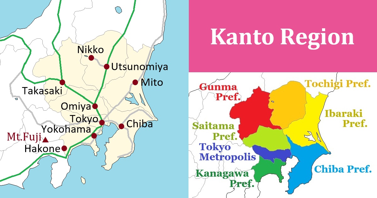
Kanto Region [関東]
Outline of Kanto Region
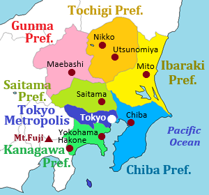
Kanto Region is the southeast part of Honshu Island in Japan.
The last "o" in "Kanto" is pronounced long, so it is read as "Kantō" in Japanese.
It has an area of about 200 km from east to west, and about 250 km from north to south.
The west and north sides of the region are mountainous, but the other main part is Kanto Plain which is the widest plain in Japan.
This region faces to the Pacific Ocean.
There is Boso Peninsula in the southeast part of the region and it surrounds Tokyo Bay to the west side of the peninsula.
There is Tokyo Metropolis on the west coast of Tokyo Bay.
It is the capital and the largest city in Japan.
Tokyo is the center of politics, the economy, and culture in Japan.
Tokyo Metropolis has a population of about 14 million people.
As Tokyo is the capital, a large population is concentrated in the Kanto Region.
There are seven prefectures in the Kanto region.
The total population in Kanto region including Tokyo Metropolis is over 43 million.
That accounts for 35% of Japan's total population.
The area within 20 km from the center of Tokyo is filled with buildings and houses.
And the scenery of rural area is seen 30 to 50 km away from the center of Tokyo.
Main railway and highway routes connect between the prefectures in Kanto region and Tokyo.
Trains and buses are operated frequently, so it is convenient to visit the prefectures.
There is Narita International Airport in Chiba Prefecture located to the east of Tokyo, and there is Haneda Airport near central Tokyo.
Most travelers visiting Japan set foot here first.
Guide of each prefecture Kanto Region
Tokyo Metropolis
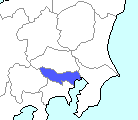
Tokyo is the center of Japan.
In Japanese, both vowels "o" in the word of "Tokyo" are pronounced long as "Tōkyō".
Until the 16th century, Edo (江戸) had been one of local town in eastern Japan.
After a long period of civil war, Tokugawa Ieyasu established a government in Edo in 1603, and constructed the massive Edo Castle to serve as the center of government.
And he also built a town around the castle.
This town developed and became the heart of Japan.
Sushi, Kabuki, Sumo, Ukiyoe (Woodblock prints), etc.
Much of the Japanese culture that foreigners are interested in today were created in Edo.
In 1868, when the era of the samurai came to an end, new Meiji government was formed with the Emperor Meiji at its head.
And, "Edo" was changed to "Tokyo" meaning "eastern capital".
Imperial Palace was built on the site of Edo Castle.
And, the Emperor moved to the Imperial Palace in Tokyo from Kyoto.
Kyoto had served as the capital of Japan for over 1,000 years since 794, but Tokyo became the only capital of Japan at that time.
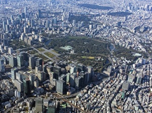
Imperial Palace in central Tokyo
The area of Tokyo Metropolis is long and narrow from east to west.
From an administrative standpoint, the central area of Tokyo spans about 30 km along the coast of Tokyo Bay.
This area is officially called as "Special Wards of Tokyo".
Or, it consists of 23 wards, so it is also called "Tokyo's 23 wards".
In any case, the name "Tokyo City" doesn't exist.
Generally, when people say "central Tokyo" or simply "Tokyo", they are referring to this area.
Buildings and houses are packed tightly into this area, and 10 million people live in this narrow area.
The remaining area to the west of "Special Wards of Tokyo" is called "Tama area".
The eastern half of Tama area forms commuter towns made up of many cities.
The western half is a mountainous area.
There are mountains having altitudes of over 2,000 meters along the western prefectural border.
Kanagawa Prefecture
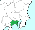
Kanagawa Prefecture is located just south of Tokyo Metropolis.
The east coast faces Tokyo Bay, and the south coast faces Sagami Bay.
The eastern part of the prefecture borders Tokyo, and there are two large cities of Kawasaki and Yokohama.
The combined population of these two cities exceeds 5 million.
The coastal area is an industrial zone, and the othe areas consist of vast commuter towns for Tokyo.
Yokohama was opened in 1859 as a trading port town for Tokyo, so Yokohama Port has become a historic tourist spot.
Miura Peninsula extends southward from Yokohama, and forms the entrance to Tokyo Bay.
The northern part of this peninsula is Yokosuka city, which borders Yokohama city.
This area developed as a military port and is now home to a U.S. Navy base.
Kamakura is a historic city facing Sagami Bay.
This is the town where the samurai seized actual power and established a government for the first time at the end of the 12th century.
The western half of the prefecture is mountainous, and there is very popular tourist spot Hakone.
Chiba Prefecture
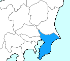
Chiba Prefecture is located just east of Tokyo Metropolis.
The northern area adjacent to Tokyo is a densely populated area of commuter towns serving the Tokyo metropolitan area.
Chiba city in the area is a major city with a population of nearly one million and is the prefectural capital.
Chiba city is the prefectural capital, and is at the northeast end of Tokyo Bay.
Narita International Airport, Japan's largest airport, is located in Narita City to the northeast.
When many of the foreigners visit Japan, the first step is probably marked on Chiba Prefecture.
There is also Naritasan Shinshoji temple in Narita city and it is one of popular Buddhist temples.
And, Sawara city near Narita city is a traditional town with historic streetscapes.
The southen half of the prefecture is Boso Peninsula.
The west coast faces Tokyo Bay, and the east coast faces the Pacific Ocean.
In this area, rural areas and forests spread.
The area consists of rolling hills ranging from 200 to 300 meters in elevation, and there is no mountain range.
The climate of the Boso Peninsula is mild.
The cultivation of early-spring flowers taking advantage of the mild climate is well known.
Beach resorts dot along the Pacific coast of the peninsula.
Saitama Prefecture
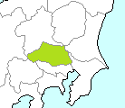
Saitama Prefecture is located just north of Tokyo Metropolis.
In the area close to Tokyo, there are many cities, then it is formed the north part of Tokyo metropolitan area.
The prefectural capital is Saitama city located in the southeast part.
It is located only 20 km north of central Tokyo.
But it has a population of over 1.2 million people.
Omiya area in the city has an important junction of Shinkanasen and JR Line.
Omiya is the next Shinkansen station of Ueno in Tokyo, and Tohoku Shinkansen and Joetsu Shinkansen branch off from here.
There is Kawagoe city to the west of Saitama city.
The town retains its old streetscape in Edo-period, so it is known as "Little Edo".
The western half of the prefecture is mountainous.
There are many mountains as much as 1,000 to 2,000 meters high.
In the center of the area, there is Chichibu city, then the area is often called "Chichibu region".
This prefecture has many railroad lines, but most lines lead to Tokyo.
However, it is relatively convenient to visit this prefecture from Tokyo.
Ibaraki Prefecture
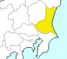
Ibaraki Prefecture is located at the northeast part of Kanto region, and the whole east coast faces the Pacific Ocean.
Nearly along the southern prefecture's border, Tone River flows.
It is the large river flowing through Kanto region.
And, there is the Japan's second largest lake Kasumigaura in the downstream part.
Also many other lakes are around it.
In this region, numerous small rivers and canals flow through the vast plains connecting them and creating a landscape known as the Suigo (Water town).
It has flourished through water-transport since the Edo period, and today it retains a beautiful landscape rich in the atmosphere of a traditional waterside town.
The central city of this prefecture is Mito located around the center of the prefecture.
During the Edo period, it was one of the major cities governed by figures associated with the shogunate.
The northern part of Ibaraki Prefecture is a mountainous area.
Fukuroda Falls located in the mountains is one of Japan's three most famous waterfalls.
Tochigi Prefecture
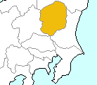
Tochigi Prefecture is located at the north part of Kanto region.
The west part of the prefecture is mountainous, and the east part is hilly.
So the central area is flatland.
The prefectural capital is Utsunomiya city, which is located at the just south of the central point of the prefecture.
Nikko city is located in the mountainous region to the west of there.
Nikko is a religious city built in the 17th century and has been designated a World Heritage Site.
The area around Nikko is dotted with Lake Chuzenji, highland wetlands, and hot spring resorts in the mountains.
In the northern part of the prefecture lies Nasu Highland, which has long been a popular summer resort.
The southern part of the prefecture is located at the northern edge of the vast Kanto Plain and there are the towns such as Ashikaga and Ashikaga where historic landscapes remain.
Gunma Prefecture
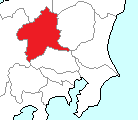
Gunma Prefecture is located at the northwest part of Kanto region.
There is flat land at the southeast part of the prefecture, and most cities of the prefecture are in the area.
The prefectural capital is Maebashi city.
And, there is Takasaki city at just southwest of Maebashi.
Takasaki is the important junction of railway.
Joetsu Shinkansen for Niigata and Hokuriku Shinkansen for Nagano and Hokuriku Region diverge at Takasaki.
Other area of the prefecture is almost mountainous.
Particularly, very steep mountains lie along the northern prefectural border.
They are a part of dividing ridge of water between the Pacific side and Sea of Japan side in Japan.
This area has heavy snowfall in the winter.
In the mountainous area, there are many popular Onsen (hot spring) resorts such as Kusatsu, Ikaho, Shima, etc.
Gunma is one of the prefectures with the most well-known Onsen in Japan.
Transportation in Kanto Region
Airport
There are two major airports in Kanto Region.
They are Narita International Airport and Haneda Airport.
Narita Airport is the biggest international airport in Japan, and it has the flights from a lot of cities in the world.
It is located in the northern part of Chiba Prefecture, and you can reach central Tokyo in about an hour by train or highway bus.
Haneda Airport is the biggest domestic airport in Japan, and has also the international flights from main cities in East Asia and South-East Asia, some cities in USA, and a few cities in Europe.
Ibaraki Airport is the only regional airport in the Kanto region, and is located in the southern part of Ibaraki Prefecture.
There are the flights to Sapporo in Hokkaido and to several cities in Kansai and Kyushu regions.
Railway
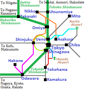
Main railway lines of JR in Kanto Region.
Green lines are Shinkansen.
Thin grey lines are JR Lines and yellowish green line is JR Yamanote loop line.
Other colored line is the limited express of the other railway compnies.
The central railway station in Tokyo is Tokyo Station.
It is also the central station of JR lines in whole Japan.
All Shinkansen trains start from Tokyo.
By Shinkansen, we can go to main cities in Honshu Island.
Many railway lines including the lines in the attached map run in Kanto Region.
JR lines including Shinkansen has the dense network in Kanto Region.
The lines of some other railway companies radiate from the center of Tokyo.
Especially, Tobu Railway operates the limited express to Nikko, and Odakyu Railway operates the limited express to Hakone.
Keisei Railway has the line to Narita International Airport, and Keikyu Railway has the line to Haneda Airport.
Keio Railway, Tokyu Railway and Seibu Railway are primarily commuter trains.
Each has the lines extending to Mount Takao, the harbor area of Yokohama, Chichibu area in Saitama Prefecture.
We can visit the main cities in Kanto Region within 2 hours from Tokyo.
Under the central Tokyo, there is a complicated network of subways.
These lines are operated by Tokyo Metro and Toei (Tokyo Metropolitan Bureau of Transportation).
Some lines of subway are connected with the line of the other railway company, so through-service is provided.
In waterfront area of Tokyo, Tokyo Monorail which connects to Haneda Airport, and the Yurikamome which is a new transit system connecting to the Odaiba area are operated.